Construction management
Maintenance management
/Disaster Prevention
/Disaster Prevention
Maintenance Management/Disaster Prevention
- GPS displacement measurement of deformation spots or Landslides
- Monitoring system is not affected by the weather
- Use in civil engineering GPS measurement and the Internet keeps costs low
- The compact, lightweight GPS equipment is easy to install
- No need to purchase any software or computer
- Provision of information relating to rainfall, including effective precipitation and rainfall prediction, helps when making decisions regarding precautionary evacuation
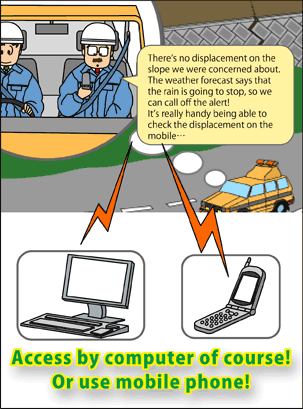
- Real-time measurment data can be checked for 24 hours via the Internet/mobile phone
- Our own original error-processing allows for highly-accurate, three-dimensional measurements within millimeter
- Download or print out measurement results with a single click
- The monitoring service for 24 hours at the Monitoring center is an optional extra
- A fixed monthly cost system enables monitoring even for short periods
Dam site management
The number of measuring points/frequency of instrument can be modified to match changes in the dam management system, to enable the acquisition of stable measurement data while keeping costs low.
e.g.)
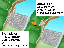
* Measurement of a fill dam site (From initial impoundment to maintenance)
* Landslide slopes in the area around the reservoir
e.g.)
* Measurement of a fill dam site (From initial impoundment to maintenance)
* Landslide slopes in the area around the reservoir
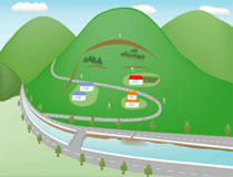
Roadside slope management
GPS Sensors are installed on massive slope faces or slope faces with unstable factor, and displacement measurement/monitoring is carried out in real time. The number of sensors and frequency of measuring is reviewed flexibly to provide the optimum measuring management.
e.g.)
* Cuttings (Massive slope face, unstable slope)
* Embankment (Slip monitoring, settling monitoring)
* Displacement measurement of tunnel entrance, retaining walls of all kinds
e.g.)
* Cuttings (Massive slope face, unstable slope)
* Embankment (Slip monitoring, settling monitoring)
* Displacement measurement of tunnel entrance, retaining walls of all kinds
Landslide measurement
GPS sensors are installed in and around the site of a Landslide, and displacement measurement/monitoring is carried out in real time. The number of sensors and frequency of measuring is reviewed flexibly according to the degree of activity, to provide the optimum measuring management.
e.g.)
* General measurement of Landslides
* Verification of provisional stability assessment
* Landslide peripheral to a dam lake/reservoir
e.g.)
* General measurement of Landslides
* Verification of provisional stability assessment
* Landslide peripheral to a dam lake/reservoir
Steel tower management
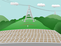
For the maintenance of steel towers in mountainous areas, sensors are installed on the ground of the foundations, the surrounding ground and on the tower itself, and displacement measurement/monitoring is carried out in real time.
The number of sensors and frequency of measuring is reviewed flexibly, to provide the optimum measuring management.
e.g.)
* Maintenance and condition screening of steel towers
* Steel towers erected on unstable ground (Landslide/landslide occurring close to the tower)
* When construction work is carried out in the vicinity of the tower
Landfill management
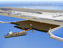
After the completion of work, subsidence/displacement of the ground surface of the landfill site is measured/monitored in real time.
The number of sensors and frequency of measuring is reviewed flexibly, to provide the optimum measuring management.
e.g.)
* Maintenance/monitoring of an offshore airport
* Maintenance/monitoring of reclaimed land/developed landfill site
* Measurement of structures/buildings on landfill sites (subsidence/tilt)