【With GPS however…】
- No limit to measuring
- Acquire three-dimensional coordinates (x, y, z)
- Measures both horizontal and vertical displacement
- Maintenance-free and durable (no movable parts)
GPS measurement has numerous advantages over traditional methods such as each measurement being independent, meaning there are no cumulative errors.
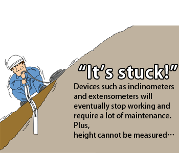
【Common problems with traditional GPS measurement…】
- Low measurement accuracy (only accurate to centimeters)
- High operational/running cost
However, our engineers solved these problems with Shamen-net by developing a GPS sensor specifically for measuring slopes※ and by eliminating errors using the time series statistical method.※
GPS sensor designed for measuring slopes

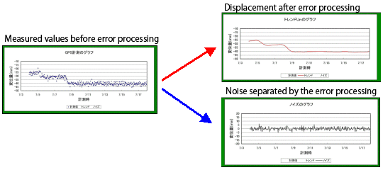
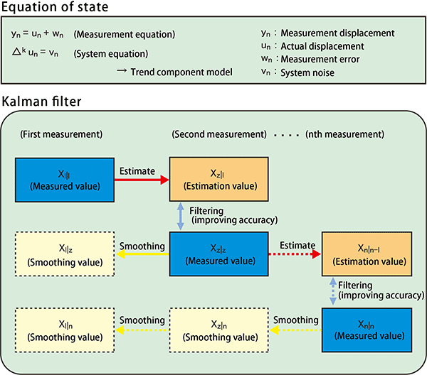
Eliminating errors using the time series statistical method
The GPS measurements include the errors, which occur due to the influence of the ionosphere and atmosphere, causing the measurement values to fluctuate by up to dozens of millimeters. This makes it difficult to detect slope displacement down to several millimeters. Shamen-net has resolved such issues to enable highly accurate (to 2 millimeters) slope displacement monitoring. It achieves this through time series statistical processing of the measurement data using a trend model to separate any measurement errors (Wn) from the actual displacement (Un) values.
- Evaluation of slope stability using displacement measurement
- G-TrendTM
- Slope measurement dedicated GPS system